Berufsgenossenschaftliche Unfallklinik | |
|---|---|
 | |
| Kliniken | |

Auf dem Schnarrenberg liegt oberhalb des Uni-Klinikums die BG-Klinik, früher Berufsgenossenschaftliche Unfallklinik. Die Chirurgie der BG ist für ihre Qualität bekannt. Es gibt eine Ambulanz, in der Hautverletzungen behandelt werden.
Lage[Bearbeiten | Quelltext bearbeiten]
Die BG-Gebäude sind auf halber Höhe zwischen dem Universitätsklinikum und der Morgenstelle auf dem Schnarrenberg gelegen. Die BG-Klinik liegt damit in unmittelbarer Nachbarschaft zu den Uni-Kliniken Berg.
Öffentliche Verkehrsmittel[Bearbeiten | Quelltext bearbeiten]
Die Bushaltestelle BG Unfallklinik (frühere Bezeichnung) wird von den Buslinien 13, 14, 15, 17, 18, 19, 20 und 36 angefahren. Außerdem halten dort die Nachtbuslinien N93 und N94.

Weitere Bilder[Bearbeiten | Quelltext bearbeiten]
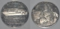
Medaille der Berufsgenossenschaftlichen Unfallklinik Tübingen, Berufsgenossenschaftliches Sportfest für Querschnittslähmung, 1970

