Kirnbachsträßchen
Aus TUEpedia
(Unterschied) ← Nächstältere Version | Aktuelle Version (Unterschied) | Nächstjüngere Version → (Unterschied)
Wechseln zu:Navigation, Suche
| KirnbachsträßchenGeo-Cache leeren | |
|---|---|
Die Karte wird geladen … {"minzoom":false,"maxzoom":false,"mappingservice":"leaflet","width":"auto","height":"350px","centre":false,"title":"","label":"","icon":"","lines":[],"polygons":[],"circles":[],"rectangles":[],"copycoords":false,"static":false,"zoom":false,"defzoom":14,"layers":["OpenStreetMap"],"image layers":[],"overlays":[],"resizable":false,"fullscreen":false,"scrollwheelzoom":true,"cluster":false,"clustermaxzoom":20,"clusterzoomonclick":true,"clustermaxradius":80,"clusterspiderfy":true,"geojson":{"type":"FeatureCollection","features":[{"type":"Feature","properties":{"stroke-width":5,"stroke-opacity":0.7},"geometry":{"type":"LineString","coordinates":[[9.0742132,48.549185],[9.074471,48.5493822],[9.074754,48.5495904]]}},{"type":"Feature","properties":{"stroke-width":5,"stroke-opacity":0.7},"geometry":{"type":"LineString","coordinates":[[9.0939874,48.5721976],[9.0936259,48.5736292],[9.0935546,48.5742712],[9.0933712,48.5759241],[9.0932377,48.5771265],[9.093211,48.5779151]]}},{"type":"Feature","properties":{"stroke-width":5,"stroke-opacity":0.7},"geometry":{"type":"LineString","coordinates":[[9.0940247,48.5720252],[9.0939874,48.5721976]]}},{"type":"Feature","properties":{"stroke-width":5,"stroke-opacity":0.7},"geometry":{"type":"LineString","coordinates":[[9.0939707,48.5796722],[9.0945326,48.5802963],[9.0946466,48.5805359],[9.094788,48.5808449],[9.0945562,48.5814184],[9.0941002,48.5821199],[9.0939559,48.5824487],[9.0939829,48.5827797],[9.0943404,48.5838825],[9.0947615,48.5852712],[9.0948929,48.585723],[9.0951835,48.5860956]]}},{"type":"Feature","properties":{"stroke-width":5,"stroke-opacity":0.7},"geometry":{"type":"LineString","coordinates":[[9.093211,48.5779151],[9.0932042,48.5781098]]}},{"type":"Feature","properties":{"stroke-width":5,"stroke-opacity":0.7},"geometry":{"type":"LineString","coordinates":[[9.0749656,48.5498195],[9.0753709,48.5503561],[9.0759563,48.550973],[9.0762939,48.5513725],[9.0774806,48.5520678],[9.0779599,48.5523474],[9.0782734,48.5524916],[9.0792245,48.5528472],[9.0797231,48.5530345],[9.0804643,48.5538061],[9.0818572,48.5547447],[9.0826579,48.5551654],[9.082948,48.5552918],[9.083355,48.5554316],[9.0837007,48.5555939],[9.0841424,48.5558522]]}},{"type":"Feature","properties":{"stroke-width":5,"stroke-opacity":0.7},"geometry":{"type":"LineString","coordinates":[[9.0876136,48.5577453],[9.0879511,48.5578992],[9.0885075,48.5583168],[9.0900743,48.559502],[9.0911264,48.5599636],[9.0916628,48.5602292],[9.0920787,48.5605493],[9.0922952,48.5607329],[9.0928573,48.5612762],[9.0930846,48.5614715],[9.0932686,48.5617278],[9.0933795,48.5620609],[9.0933234,48.5626412],[9.0933076,48.5657625],[9.0934315,48.566033],[9.0936483,48.5662745],[9.0937822,48.5663921],[9.0947211,48.5674353],[9.0952119,48.5679317],[9.0954225,48.5681996],[9.0956014,48.5684664]]}},{"type":"Feature","properties":{"stroke-width":5,"stroke-opacity":0.7},"geometry":{"type":"LineString","coordinates":[[9.074754,48.5495904],[9.0749656,48.5498195]]}},{"type":"Feature","properties":{"stroke-width":5,"stroke-opacity":0.7},"geometry":{"type":"LineString","coordinates":[[9.0932042,48.5781098],[9.0931764,48.5783368],[9.0932096,48.578681],[9.0934376,48.5790175],[9.0939707,48.5796722]]}},{"type":"Feature","properties":{"stroke-width":5,"stroke-opacity":0.7},"geometry":{"type":"LineString","coordinates":[[9.0956014,48.5684664],[9.0957227,48.5688371],[9.0956815,48.5692142],[9.0955649,48.5694163],[9.094414,48.570823],[9.0942069,48.5713387],[9.0940247,48.5720252]]}},{"type":"Feature","properties":{"stroke-width":5,"stroke-opacity":0.7},"geometry":{"type":"LineString","coordinates":[[9.0841424,48.5558522],[9.0844319,48.5560108],[9.0851411,48.5565987],[9.0855988,48.5569094],[9.0864521,48.5572767],[9.0876136,48.5577453]]}}]},"clicktarget":"","GeoJsonSource":null,"GeoJsonRevisionId":null,"imageLayers":[],"locations":[],"imageoverlays":null} | |
| track | |
| Oberfläche | compacted, Splitt |
| Fahrräder | erlaubt |
| Cache leeren | |

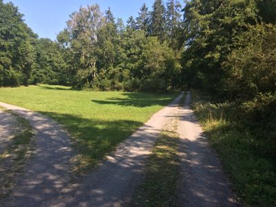
Das Kirnbachsträßchen in Blickrichtung Westen wenige hundert Meter vor der Kreuzung mit dem Spartakusweg

Weg neben dem Bachlauf etwa in der Mitte zwischen Quelle und Mündung bei der Mauterswiese
Das Kirnbachsträßchen oder Kirnbachsträßle führt durch das Tal des Kirnbachs durch den Schönbuch. Es beginnt an der Sonntagsstelle an der Bebenhäuser Straße und führt bis in die Nähe der Eckbergkreuzung.